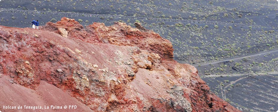
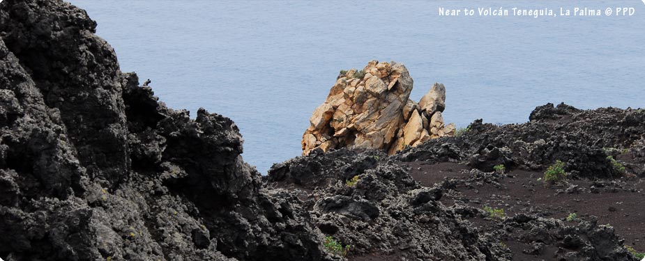
The Canary Islands are well-known for their volcanic landscapes and La Palma is no exception. The information below is based on our own walks within the volcanic regions of the island in 2008. Looking back at our photos, I remember why my nerves kicked in but it was worth the effort, fear and sense of achievement at the end of the walk! We were amazed at the stunning variations of rock colours especially on and around Volcán Teneguía.
Volcán San Antonio and Volcán Teneguía
These are both situated in the south of the island around Fuencaliente which is close to where we stayed. Start at the visitor center just outside the town and follow the trail all the way down to the lighthouse which offers a vast array of scenery and flora along the way. The trails are good underfoot and offer various grades for the adventurous or those who just want to ‘stand’ on a volcano without having to climb one! Not all volcanoes look the same though so if you visit Volcán San Antonio, try to make it down to Volcán Teneguia to see the differences between the two. The landscapes are amazing.
You can see and stand on Volcán San Antonio by just parking at the visitor centre and walking a very short distance to reach the start of the path. Volcán Teneguía is far more impressive though and well worth the hike!
OUR WALK – Fuencaliente Volcano Route Down to the Lighthouse
We caught the bus from our hotel and walked the following route which was amazing but pretty exhausting too! There are options for the long hike or shorter walks. Walk as far as you want to with this walk which offers variations for all levels of walkers and includes two volcanoes plus the lighthouse.
Starting Point: Volcán San Antonio Visitor Centre, Fuencaliente
Distance: Approx. 6 km from Volcán San Antonio to the Fuencaliente Lighthouse
Notes: Some fairly steep parts of the trail which can be avoided and generally a steady slope down to the lighthouse, all off road apart from the last part from the lighthouse to the La Palma Princess hotel (if travelling this far)
Facilities: Car park, toilets, museum
Highlights: Incredible volcanic landscapes and flowers plus a great sense of achievement at the end!
Caldera de Taburiente
North of the island lies the largest known crater and National Park of the Caldera de Taburiente. The Caldera crater as seen today was formed when the volcano collapsed during a landslide some 500,000 years ago. Roque de los Muchachos (2,423m), is the highest point where an Astrophysical Observatory can be found.
Walking within the caldera is considered to be one of the best possible walks on the island however heavy or persistent rainfall can loosen the rocks and this is carefully monitored by the park authorities. Ensure you have some knowledge of the area or use a professional walking guide if you are visiting and also check that the park is open before setting off.
Unfortunately the park was closed due to rain during our visit in February 2008 and our organised walk with a guide was cancelled twice so we never made it there. Bear this in mind and book the walk at the start of your holiday if you can. It was something that we really wanted to do but couldn’t on this occasion.